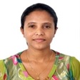
Name : D.D D. Weragodatenna
Contact : dddilhari@gmail.com/ dilhari@nara.ac.lk
Education Qualification
- Master of Science in Geo-Informatics, (2012 -2014), University of Sri Jayewardenepura, Sri Lanka
- A. Special in Geography, (2002-2006), University of Peradeniya, Sri Lanka
Research interest
- GIS and Remote Sensing Application for the coastal and Aquatic Environment
Working Experience
- Senior Scientist, National Aquatic Resource Research and Development Agency (NARA), at present
- Scientist, National Aquatic Resource Research and Development Agency (NARA), 2011 – 2020
- Research Officer, National Aquatic Resource Research and Development Agency (NARA), Dec 2010 – 2011
- Assistant Programme Officer, International Union for Conservation of Nature (IUCN), 2008 – Dec 2010
- Research Assistant, Center for Environmental Studies (CES), University of Peradeniya, 2006- 2008
Publications
- D.D.D. Weragodatenna and A.B.A.K. Gunaratne, Detection of aquatic habitats by Geo-Eye satellite images at the Palk Strait, Sri Lanka, Asian Journal of Geoınformatıcs, Vol 15, No 4 (2015)
- D.D.D. Weragodatenna and A.B.A.K. Gunaratne, Change detection of mangrove coverage in Puttalam Lagoon of Sri Lanka using satellite remote sensing techniques, Journal of National Aquatic Resources Research and Development Agency, Vol. 44.
- Weragodatenna Dilhari, (2010), GIS Atlas for Puttalam lagoon: As an Assistance for Natural resource Management. IUCN Sri Lanka.
- Weragodatenna Dilhari, (2010), User’s Guide to ArcView 3.3 for Land Use Planning Officers in Puttalam District. IUCN Sri Lanka.
Conference proceeding
- R. Ramya and D.D.D. Weragodatenna, Change Detection of Forest Cover in Mannar District by Landsat Images, Proceedings of Asian Association on Remote sensing, 2016.
- D.D.D. Weragodatenna, M.G.W.M.K. Gunarathne and A.B.A.K. Gunarathne, Identification of spatial distribution of coral reef in Pigeon Island, Trincomalee by remotely sensed data, proceeding of Journal of National Aquatic Resources Research and Development Agency, Scientific Sessions 2017
- M.Naveenan, D.D.D. Weragodatenna, A.B.A.K. Gunaratne, R.M.C.W.M. Rathnayake and S.C. Jayamanne. 2015., Remote Sensing and GIS approach in assessment and conservation of seagrass beds in the coastal stretch, Gulf of Mannar, proceeding of Journal of National Aquatic Resources Research and Development Agency, Scientific Sessions 2015
- R.M.H.N.K Nisansala, D.D.D. Weragodatenna, A.B.A.K. Gunaratne, R.M.C.W.M. Rathnayake and S.C. Jayamanne. 2015., Assessment of the impact of aquaculture practices in the Puttalam lagoon on the mangrove ecosystem by using remote sensing and GIS technology, proceeding of Journal of National Aquatic Resources Research and Development Agency, Scientific Sessions 2015.
- Weragodatenna D.D.D, Jayathilaka R.M.R.M, “Modeling of Tsunami inundation and hazard mitigation - A case study of Hambantota urban area”, proceeding of Journal of National Aquatic Resources Research and Development Agency
- Weragodatenna Dilhari, A.B.A.K. Gunarathne, Detection of seagrass beds by IKONOS images, proceeding of Journal of National Aquatic Resources Research and Development Agency Scientific Sessions-2012
- R. Alagan, D. Weragodetenne, U. Jeyaraman and C. Premaratne, (2007), Virtual Peradeniya :A GIS System for the University of Peradeniya, Peradeniya university Research Session (PURSE), Volume 12, Part II,, pp329‐331
